Page 1 of 2 12 LastLast
Results 1 to 24 of 32

Thread: Best Rides in the State: A google maps database

  1. #1
    Member Telefonica's Avatar
    Join Date
    Mar 2005
    Location
    Littleton
    Posts
    81

    Best Rides in the State: A google maps database

    I would like to start a thread solely devoted to posting your favorite rides. I always love learning new rides because riding the same stuff over and over again gets pretty boring. To contribute, please go to www.maps.google.com. Click the "Get Directions" button and type in two random locations near the ride (they don't have to be terribly close to the ride). Then move the "A" and "B" points around on the map to where you want (these will be the start and end points of the ride, respectively). You can then click and drag on the blue line to move the route along as you please. When you're done, click the "Link" button in the upper right, next to "Print" and "Send". Copy the link that appears in the drop down box (the top link, not the bottom one) and paste it in this thread. Please try to keep the thread clean by:
    1. Only posting new routes
    2. Only commenting on routes posted by others, no off topic stuff please (take it to pm)

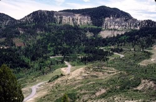
    Golden Gate Canyon - This is a fun ride that starts and ends in Golden; the ride ends only a quarter mile (or so) from where it begins. If the traffic isn't bad, enjoy the beautiful drive up to Black Hawk, but the real fun begins on the way back on Golden Gate Canyon Rd. (be sure to watch out for gravel on this road. It isn't heavily traveled. Also, there are a few areas with homes and we should be mindful of the local residents, less they start complaining to the 5-0!)

    Look Out Mountain - This is a short little ride, but it packs a punch. Enjoy the twisties as you carve up Look Out Mountain (and pass the beautiful "M" - Go CSM!). Be sure to stop and check out the awesome view right where I've placed "B". Oh, and check out the Coors Brewery for some free beer when you're done (must be 21 years or older to enjoy free alchi )!

    South Deer Creek Rd. Deer Creek Rd is one of my favorite rides - it's very close to the city and has some great twisties and beautiful views, but be mindful of two things: 1) This route is heavily patrolled by the 5-0 during the summer months. 2) At night, this route is populated by deer (hence the name). I've had a few close calls with deer that apparently wanted to be made into minced meat.

    P.S. If this becomes popular enough, may I request that we make this a "sticky"?
    Last edited by Telefonica; Fri Jan 2nd, 2009 at 12:09 PM.
    Adam

    2002 GSX-R600 Telefonica: Sold to fix car

    2002 Suzuki Hayabusa

  2. #2

    Re: Best Rides in the State: A google maps database

    Coal Creek W, Peak to Peak N, St Vrain E. St Vrain is one of the best bits of road I've encountered in CO:
    http://maps.google.com/maps?f=d&sadd...,1.382904&z=10

    Deckers, of course:
    http://maps.google.com/maps?f=d&sadd...4&ie=UTF8&z=10
    Last edited by peteremsley; Thu Jan 1st, 2009 at 09:18 PM. Reason: oops... sorry Ralph

  3. #3
    Member slayermd's Avatar
    Join Date
    Mar 2008
    Location
    Westminster
    Posts
    447

    Re: Best Rides in the State: A google maps database

    I like this route.
    -340 Miles
    -I-25 North/Hwy14 West to Walden/Hwy125 South To Granby/Trail Ridge Road/South 7/Hwy72 to Ned/119 to Boulder

    This one is cool too.
    Last edited by slayermd; Fri Jan 2nd, 2009 at 10:08 AM.
    2003 Suzuki SV1000S
    1993 Yamaha FZR 600 Tear Down!!
    1996 Yamaha FZR 600 <Sold>
    Twitter!

  4. #4
    Say what again... Site Admin rforsythe's Avatar
    Join Date
    Sep 2002
    Location
    On the brink
    Posts
    8,013

    Re: Best Rides in the State: A google maps database

    I like this thread. To make it more useful please remember when you post:
    1. Actually make a Google map of your route and give us the link to it.
    2. When you post a link, maybe also type up a brief description of what it is.
    Asshole Nazi devil moderator out to get each and every one of you

    Nothing in all the world is more dangerous
    than sincere ignorance
    and conscientious stupidity.
    - Martin Luther King, Jr.


    disce quasi semper victurus vive quasi cras moriturus

    The return of MRA #321! Sponsored by Western Ambulance, Chicane Trackdays, and a very patient wife...

  5. #5
    Gold Member Yearly Supporter mtnairlover's Avatar
    Join Date
    Mar 2006
    Location
    finally home
    Posts
    6,402

    Re: Best Rides in the State: A google maps database

    You got it...I can follow directions

    Loveland to Rustic via Stove Prairie
    ...back around Horsetooth and home to Loveland again. Take the back roads to get to Poudre Canyon. Stove Prairie road is a nice tight winding road along the foothills going North of Masonville. Once you get to Poudre Canyon (hwy14), go West to Rustic. There's a lodger there called Glen Echo, with a restaurant that has some pretty good biscuits and gravy...or so I've heard. Take hwy14 back East to Ft. Collins, but instead of going through Ft. Collins, cut through Bellevue and around Horsetooth Res. back to Masonville and then to hwy34. this is a great ride for breakfast with friends and some fun. Takes a little bit of your morning and gets you home before noon to take care of other things.

    Loveland to Estes via Devil's Gulch...to Lyons via hwy7, back up to Estes and then back to Loveland. Take hwy34 to the turnoff by Drake which is also called Devil's Gulch Road and takes you through Glen Haven. When you get to the end of the road, you are on the Northeast side of Estes Park. Follow the signs to find hwy7 from Estes and take hwy7 around to Lyons. If you don't stop in Lyons, just continue back up to Estes, via hwy36 to Estes and then back down to Loveland via hwy34. Hwy7 is a wonderful road for twists and turns throughout the year, because it is a south-facing road and so it stays relatively clean. This isn't a very long ride either and can take maybe 2 hours if all you do is ride.

    Left-hand Canyon to Ward to hwy7 and down to Lyons. I'll this ride coming home from work just to get in some twists and turns and get it out of the system. Left-hand canyon is tight and twisty in the lower elevations. When you get up to Ward, you come out on the Peak to Peak hwy. Take that going North to the hwy7 turn off and then down hwy 7...duh;-)

    Lyons to Blackhawk
    This is an all day ride...(brunch time)...then to Berthoud Pass and then over Willow Creek Pass and then over Cameron Pass to Ft. Collins and home to Loveland. I'll meet up with people in Lyons and then head up hwy7 to the Peak to Peak hwy turnoff. We head south on the P2P to Nederland and then further to Blackhawk for brunch. After that, it's over Central City Parkway to I70 and then to the Berthoud Pass turn off and to Winter Park. Next, you go through Granby with a stop for gas and then turn off after Granby to head up over Willow Creek Pass and to Walden. From Walden. Get gas in Walden, cuz it's about 110 miles to Ft. Collins from there. Take hwy 14 East over Cameron Pass and all the way back to Ft. Collins.

    Coal Creek to Golden Gate
    This is a short ride through a couple of tight, twisty canyons that could be maybe an early morning weekend run, or an after work shake out the bugs type of ride.

    Not sure how long my login lasts, so this is gonna be several edits.
    Last edited by mtnairlover; Sun Jan 4th, 2009 at 07:36 PM. Reason: tah dah...all done for now;-)
    ...ready to take on the world...one canyon at a time...

    Check out my WordPress blog -- Exploring Colorado’s 25 Scenic and Historic Byways: A two-year tour by sport bike, auto and 4×4 @ mtnairloversview

    Like my Facebook page @ Colorado Scenic Byways Tours to learn more about the byways


  6. #6
    Member Telefonica's Avatar
    Join Date
    Mar 2005
    Location
    Littleton
    Posts
    81

    Re: Best Rides in the State: A google maps database

    Quote Originally Posted by mtnairlover View Post

    Coal Creek to Golden Gate

    Not sure how long my login lasts, so this is gonna be several edits.
    Is "Gap Rd." a dirt road?
    Adam

    2002 GSX-R600 Telefonica: Sold to fix car

    2002 Suzuki Hayabusa

  7. #7
    Geriatric Curmudgeon Lifetime Supporter Nick_Ninja's Avatar
    Join Date
    Sep 2002
    Location
    Gold Hill, CO
    Posts
    8,301

    Re: Best Rides in the State: A google maps database

    Quote Originally Posted by Telefonica View Post
    Is "Gap Rd." a dirt road?
    Yes.
    "Its all about the motorbikes, always has been and always will be.". ~~ Ewan McGregor 2007

    "It's hard to play the blues when nuthin's really wrong."~~ ---- Joe Walsh 2012

    I.B.A. # 14748 124@X - YRMV

  8. #8
    Senior Member Lifetime Supporter 64BonnieLass's Avatar
    Join Date
    Oct 2006
    Location
    Boulder
    Posts
    4,175

    Re: Best Rides in the State: A google maps database

    "Keep that "what if" thought in the back of your mind; it's the angel on your shoulder balancing the devil in your right hand."

    "There are many things in life that will catch your eye, but only a few will catch your heart...pursue those."

    2005 SV650S Street

  9. #9
    Gold Member Yearly Supporter mtnairlover's Avatar
    Join Date
    Mar 2006
    Location
    finally home
    Posts
    6,402

    Re: Best Rides in the State: A google maps database

    Quote Originally Posted by Telefonica View Post
    Is "Gap Rd." a dirt road?
    Oooops...good catch.

    Fixed and thanks.

    Hmmm...seeing some of the updates to the previous routes, I know what I'll be doing when I get home tonight...
    ...ready to take on the world...one canyon at a time...

    Check out my WordPress blog -- Exploring Colorado’s 25 Scenic and Historic Byways: A two-year tour by sport bike, auto and 4×4 @ mtnairloversview

    Like my Facebook page @ Colorado Scenic Byways Tours to learn more about the byways


  10. #10
    Member fook's Avatar
    Join Date
    Sep 2007
    Location
    Firestone, CO
    Posts
    144

    Re: Best Rides in the State: A google maps database

    a couple harder to get to but well worth the effort rides of mine:

    my favorite long weekend ride:

    take off Friday Morning from Denver and head down to Pagosa Springs via Kenosha, Monarch, Slumgullion, Spring Creek and Wolf Creek passes.. with lunch either in Gunnison or Lake City... best road on the route is hwy 149(Silver Thread Scenic byway). lunch either in Gunnison or if you're in Lake City around lunch time the old Texaco station BBQ joint is good eats.

    get down to the hot springs resort, head straight over to the Mexican restaurant across the bridge to get a little bit plowed on a few margaritas and then back to the hot springs to unwind.

    wake up and head out to Durango and then up the million dollar hwy to Montrose with a little detour up hwy 92 and in and around Black Canyon before making a Gunnison home for Saturday night... if we're really lazy or putzing around we'll stop in Montrose.

    Get up on Sunday morning and ride up to Crested Butte and then 30 miles of dirt as we go over Kebler Pass and the aspen groves.. nice well travelled dirt road here and the views make it absolutely worth it.. mid September makes it into one of the most beautiful places in CO... I got a couple shots from my last trip up through there in the 2009 Pashnit motorcycle calendar this year... after that catch hwy 133 north to Glenwood Springs and I70 home....

    heading through the aspens west of Kebler pass:


    clicky for google map of ride


    another great half day ride if you find yourself down south around Pagosa is a nice loop going from Pagosa Springs down to Chama NM and then heading up hwy 17 back to Antonito in southern CO before heading back to Wolf Creek pass to Pagosa again.

    hwy 17 is particularly nice I think, always been empty whenever I've ridden it, some really nice curves and a great views.

    also, just outside Antonito is the oldest church in CO.. little bit of interesting history.

    heading up the hill on hwy 17:


    google map link of Pagosa loop
    - Jeff

  11. #11
    Senior Member Snowman's Avatar
    Join Date
    Oct 2002
    Location
    The roads of Colorado...
    Posts
    4,278

    Re: Best Rides in the State: A google maps database

    A 2 day trip from Morrison, Colorado to SantaFe, New Mexico

    I have been wanting to do this one for while.

    There has to be several of these kind of trips where you can ride for like 6 hours to reach someplace, do something there, spend the night and return without spending vacation time to do so.
    Last edited by Snowman; Sun Jan 4th, 2009 at 10:45 AM.

    MRA Racer No.427

  12. #12
    Junior Member HOBBES's Avatar
    Join Date
    Feb 2008
    Location
    Denver
    Posts
    27

    Re: Best Rides in the State: A google maps database

    Front Range Canyon Carving!


  13. #13
    Gold Member Yearly Supporter mtnairlover's Avatar
    Join Date
    Mar 2006
    Location
    finally home
    Posts
    6,402

    Re: Best Rides in the State: A google maps database

    Durango and back again. Weekend riding...2-day fun all over southwestern Colorado and back again. So, to answer Snowman's question about weekend riding without needing vacation days, I thought I'd post up the Durango ride some of us did in June of '07. The Google mapping I did is not the exact run. It shows taking a little over 15 hours and covering 655 miles. I'm not too sure about that, because my odometer showed a total of 1068 miles round trip, but I started off from Loveland and we went through Deckers to meet up with some Springs folks in Woodland Park. That took a little extra miles and more time. We rode for approximately 12 hours each day. But it was one heck of a blast.

    Different parts of the ride that are amazing include:

    Monarch Pass
    Wolf Creek Pass
    hwy 149 going down to Lake City and then South Fork
    Durango to Silverton and then Ouray
    North Rim of the Black Canyon of the Gunnison
    ...ready to take on the world...one canyon at a time...

    Check out my WordPress blog -- Exploring Colorado’s 25 Scenic and Historic Byways: A two-year tour by sport bike, auto and 4×4 @ mtnairloversview

    Like my Facebook page @ Colorado Scenic Byways Tours to learn more about the byways


  14. #14
    Member fook's Avatar
    Join Date
    Sep 2007
    Location
    Firestone, CO
    Posts
    144

    Re: Best Rides in the State: A google maps database

    there's a lot of weekender trips like this, you can mix and match many Colorado's great roads for awesome two day adventures. I often head down over Monarch to Gunnison and then hwy 149 down to Wolf Creek and into Pagosa for the night then back by either heading straight east towards Walsenburg and up the I25 corridor if i'm in a hurry or out to Durango and then north to I70 via a few different choices..

    basically my favorite roads off the front range:

    the Silver Thread(hwy 149) - you can make Pagosa or Durango your end of day destination from Denver and include this road for a great day...

    Tabaguache, hwy 141/145 - whats cool about this area is the hanging flume built into the side of the rock canyon wall... if you're taking off from Durango in the morning you can ride this by mid day and then be up to I70 with enough time to be home Sunday night.. i've only done that once and it was a loong day.

    West Elk Loop - - again, about 30 miles of well groomed dirt from 133 to Crested Butte.. this includes the north rim of the Black Canyon but if you've got time, definitely go in to the south portal of the canyon(state park fee applies).

    Los Caminos Antiguos(hwy 17) - mainly just for hwy 17 but the whole area is kind of beautiful in a different way than the Rocky Mtn roads.

    i'm curious if anyone here has ever done any trips that take them out to northern Utah/Flaming Gorge area? I've wanted to take a few long rides out that way which include hwy 191, hwy 89 outside of Logan etc..
    - Jeff

  15. #15
    Gold Member salsashark's Avatar
    Join Date
    Mar 2004
    Location
    The Malakalaka Balance Board of Trust
    Posts
    8,149

    Re: Best Rides in the State: A google maps database

    Some of my favorites in Summit County

    CO-125 From US-40 to Walden One of my personal favorites... Usually try to hit this along with a couple of passes in one day...

    Silverthorne --> Leadville -->Wolcott -->Toponas --> Kremmling Great ride, takes about a half day if starting in Silverthorne. 9 can suck if you're doing this on the weekends... lots of traffic between Kremmling and Silverthorne.

    If you want to make a day of it, combine the two and take Berthoud pass down to I-70, then make a run over Loveland pass.
    Do not put off living the life you dream of. Next year may never come. If we are always waiting for something to change...
    Retirement, the kids to leave home, the weather or the economy, that's not living. That's waiting!
    Waiting will only leaves us with unrealized dreams and empty wishes.

  16. #16
    Senior Member dapper's Avatar
    Join Date
    May 2005
    Location
    This Universe
    Posts
    1,478

    Re: Best Rides in the State: A google maps database

    http://www.cosportbikeclub.org/local/rides.html

    Engineers avoid re-inventing the wheel...
    It works! Slow in, Fast out
    "Sarcasm is difficult to convey on the internet, especially if the people reading it don't know you personally". By Spiderman
    Neither irony nor sarcasm is argument. By Rufus Choate
    Be smart, be nice, do what'cha love and always have fun.
    Let food be your medicine, and medicine be your food. - Hippocrates
    I will use treatment to help the sick. I will never use it to injure them or wrong them. I will not give poison to anyone. - The Hippocratic Oath

  17. #17
    Gold Member asp_125's Avatar
    Join Date
    Jan 2004
    Location
    BoCo
    Posts
    6,532

    Re: Best Rides in the State: A google maps database

    Million Dollar Hwy loop - Durango / Telluride / Ridgeway / Durango.

    http://maps.google.com/maps?f=d&sadd...6,2.005005&z=9

    This is a great ride if you're spending the weekend in Durango. Grab breakfast at Christina's (their ham and eggs is one HUGE slab o' ham, bone in) on the west end of town on Hwy 160, before heading west towards Mancos. A quick run through some high speed sweepers brings you into Mancos. Turn north on 184, through some rolling farmland towards Dolores. With any luck you might run into a genuine cattle drive, complete with cow patties.. slippery! Hang a right on 145 towards Telluride. Farmland gives way to two lane twisties, along the Dolores River. Red sandstone cliffs on one side, rushing rivers on the other. Climb up to the viewpoint at Lizard's Head Pass. From there the twisties continue to Telluride. Turn left on 145 and continue down a winding canyon. Turn right in Placerville and head east on 62 to Ridgeway for lunch, or continue south on 550 to Ouray for lunch. Technical switchbacks and great views greet you from Ouray, south over Red Mtn Pass and down into Silverton. Climb out of Silverton on more twisties, past Molas Pass, and then make a fast descent back to Durango.
    When life throws you curves, aim for the apex
    Current stable:09 Thruxton \ 09 FZ6S2
    Sold List:97 Ninja500R, 03 SV650K3, 01 Ducati 750Sport, 73 CB350/4, 03 F650GSA, 08 Gixxer600, 03 Gixxer600, 91 VFR750F, 09 KLX250, 06 Thruxton 900, 02 VFR800, 08 Spyder RS, 12 Street TripleR, 09 KLX250S, 16 KTMRC390, 10 F650GS
    my Facebook, SpeedShots
    Quote Originally Posted by salsashark View Post
    ... Motorcycles are kind of like Baskin Robbins... You're looking at 31 flavors of ice cream, don't you kind of want to know what they all taste like?...

  18. #18
    Senior Member CaneZach's Avatar
    Join Date
    Jan 2009
    Location
    Down in the dirty dirty
    Posts
    1,802

    Re: Best Rides in the State: A google maps database

    I'm surprised the Million Dollar Hwy wasn't listed sooner. From that list dapper had, the Mt. Evans Rd (#6 on the list) is a GREAT ride. Lots of twisties going up and down and VERY scenic.

    I like riding Deckers, as peteremsley pointed out. There's also the Bishop's Castle run on CO96 to CO165 down towards Rye and Colorado City. Also, the ride from Wetmore to Westcliffe has some decent twisties in it too:

    http://maps.google.com/maps?f=d&sadd...24,,0,1.765625
    Last edited by CaneZach; Mon Jan 5th, 2009 at 02:29 PM.

  19. #19
    Gold Member asp_125's Avatar
    Join Date
    Jan 2004
    Location
    BoCo
    Posts
    6,532

    Re: Best Rides in the State: A google maps database

    As an addition to the Deckers run. Here's a nice little loop from Woodland Park.

    Cripple Creek / Victor loop.
    Head west from Woodland Park and turn on to 67 at Divide. It gets a little twisty and roller coasty after Midland. Except for the occasional gambling bus or tourist gawker this road is not very crowded. Continue to Cripple Creek. Then head towards Victor, find Diamond Ave at the north end of town; it's one of the paved routes out, the others are dirt. Follow it until it becomes the Lazy S Ranch rd, head north until it meets back up with 67 towards Woodland park.

    http://maps.google.com/maps?f=d&sadd...,0.501251&z=11

    Dual sport route: from Victor, head east out the end of town and join up with the Phantom Canyon road, miles of twisty dirt that takes you south towards Florence. Return by the same way, or link up with 115 back to the Springs.
    Last edited by asp_125; Mon Jan 5th, 2009 at 02:40 PM.
    When life throws you curves, aim for the apex
    Current stable:09 Thruxton \ 09 FZ6S2
    Sold List:97 Ninja500R, 03 SV650K3, 01 Ducati 750Sport, 73 CB350/4, 03 F650GSA, 08 Gixxer600, 03 Gixxer600, 91 VFR750F, 09 KLX250, 06 Thruxton 900, 02 VFR800, 08 Spyder RS, 12 Street TripleR, 09 KLX250S, 16 KTMRC390, 10 F650GS
    my Facebook, SpeedShots
    Quote Originally Posted by salsashark View Post
    ... Motorcycles are kind of like Baskin Robbins... You're looking at 31 flavors of ice cream, don't you kind of want to know what they all taste like?...

  20. #20
    Senior Member CaneZach's Avatar
    Join Date
    Jan 2009
    Location
    Down in the dirty dirty
    Posts
    1,802

    Re: Best Rides in the State: A google maps database

    To tack onto the Cripple Creek/Victor loop asp just added, there's a decent ride from Cripple Creek down to CO 50 west of Canon City. Take Teller CR 1 south out of Cripple Creek and it will eventually curve its way north around Mt. Pisgah. Keep going north for about 7 miles then at Evergreen Station, take a left onto southbound Teller CR 11 for a few miles before Teller CR 11 ends at a T-intersection. At the T, take a left and you'll continue south on Teller CR 11 again. 11 eventually comes out onto CO 9 which will take you south to CO 50 outside of Canon City or north on 9 to Hartsel.

  21. #21
    Senior Member Snowman's Avatar
    Join Date
    Oct 2002
    Location
    The roads of Colorado...
    Posts
    4,278

    Re: Best Rides in the State: A google maps database

    Quote Originally Posted by dapper View Post
    Engineers avoid re-inventing the wheel...
    Obviously, you don’t know many real engineers...


    MRA Racer No.427

  22. #22
    Gold Member asp_125's Avatar
    Join Date
    Jan 2004
    Location
    BoCo
    Posts
    6,532

    Re: Best Rides in the State: A google maps database

    Western slope tour: Grand Junction / Moab / Grand Mesa

    http://maps.google.com/maps?f=d&sadd...05&ie=UTF8&z=9

    Here's a 400 mile (two day?) loop through the redrock canyons of western CO / eastern UT. From Grand Junction, head east on Rimrock Drive in the Colorado National Monument, and then through Fruita to Utah. At Cisco, get off the slab and follow the waters of the Colorado towards Moab; passing sights such as Castle Valley along UT 128.
    From Moab, head south on UT191. Turn east at UT 46. Leave the desert behind as you climb the LaSal Mtns. Re-enter Colorado on US90. Turn north at Naturita, taking 141 through Gateway.

    Return to Grand Junction at Whitewater (US50), or extend the ride with a loop over the Grand Mesa. Turn south to Delta, then north on 65 over the mesa. Rejoin I-70 near Palisade then back to Grand Junction.
    When life throws you curves, aim for the apex
    Current stable:09 Thruxton \ 09 FZ6S2
    Sold List:97 Ninja500R, 03 SV650K3, 01 Ducati 750Sport, 73 CB350/4, 03 F650GSA, 08 Gixxer600, 03 Gixxer600, 91 VFR750F, 09 KLX250, 06 Thruxton 900, 02 VFR800, 08 Spyder RS, 12 Street TripleR, 09 KLX250S, 16 KTMRC390, 10 F650GS
    my Facebook, SpeedShots
    Quote Originally Posted by salsashark View Post
    ... Motorcycles are kind of like Baskin Robbins... You're looking at 31 flavors of ice cream, don't you kind of want to know what they all taste like?...

  23. #23
    AKA "Devaclis"
    Join Date
    Jun 2004
    Location
    Occupy CSC Fuck You Ralph
    Posts
    19,633

    Re: Best Rides in the State: A google maps database

    This is the best CSC thread ever!!

    After all of my Friday Kittah threads of course.

    Keep it up guys, this is awesome info
    First rule of the internet: *bleep* you and everything you stand for. Second rule of the internet: FKZOR U AND RRYTHING U STND FR!

  24. #24
    Gold Member Yearly Supporter mtnairlover's Avatar
    Join Date
    Mar 2006
    Location
    finally home
    Posts
    6,402

    Re: Best Rides in the State: A google maps database

    Quote Originally Posted by CaneZach View Post
    I'm surprised the Million Dollar Hwy wasn't listed sooner.
    It was...post #13. I just didn't call it that...but, it's also known as the San Juan Skyway, as well.

    Anyhoo, here's another ride on the very far Western side of the state from North of I-70, starting at Rangely, going over Douglas Pass, which is quite an unknown pass and less than 9000 feet, but the road getting there is quite fun and since it's not a very well known pass, it's also pretty void of much traffic even in summer. Pass through Fruita and then take hwy141 South and pass by Gypsum Gap. This is a rock climbing haven off the beaten path and on a dirt road. If you don't want to climb rocks, just stick to hwy141 down to Dove Creek and the road becomes hwy491. Along this road just south of Dove Creek is part of the scenic byway known as Trail of the Ancients. Head East at hwy184 and catch up with hwy145, which takes you by Telluride, but you have to leave hwy145 to see Telluride which is only a couple miles East. Stick with hwy145 going Northwest back to Naturita and you've made a nice loop on roads that don't see much travel, but show a distinctly arid and colorful part of the state.

    Rangely to Naturita Loop
    is what I'll call this one.

    Pic of Douglas Pass from a Google search...
    Last edited by mtnairlover; Mon Jan 5th, 2009 at 09:27 PM.
    ...ready to take on the world...one canyon at a time...

    Check out my WordPress blog -- Exploring Colorado’s 25 Scenic and Historic Byways: A two-year tour by sport bike, auto and 4×4 @ mtnairloversview

    Like my Facebook page @ Colorado Scenic Byways Tours to learn more about the byways


Similar Threads

  1. Google maps - always on top of shit.
    By Aracheon in forum Pics and Videos
    Replies: 7
    Last Post: Fri Aug 10th, 2007, 07:12 AM

Posting Permissions

  • You may not post new threads
  • You may not post replies
  • You may not post attachments
  • You may not edit your posts
  •